Historic Survey Cairn

Unique piece of Victorian history

PHOTO: Snow on a snowgum (Eucalyptus pauciflora) in the Top of the Range garden
Macedon Regional Park > Places to visit > Historic Survey Cairn

Places to visit

Historic Survey Cairn

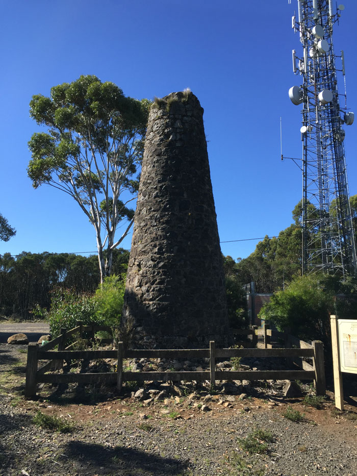
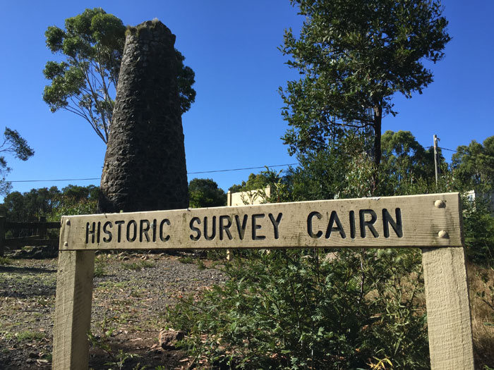
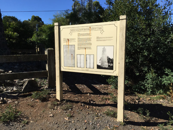
This eight metre high cairn was built in the 1860s as a reference point for land surveys. It is one of only three mortared stone Geodetic Triangulation Cairns in Victoria.

How to get to Historic Survey Cairn

Start at Harbison Picnic Ground, located next to the tea rooms. Then head north along one of the two short walking trails, in 300m from the car park you will reach the survey cairn. Be careful when crossing the road next to the cairn.

Macedon Regional Park Summit Precinct

Geodesic Survey Cairn

Things to see and do

  • Historical monument

Facilities

  • Information board
  • Car parking
Information board
get the latest...
Want to stay up to date with the latest info, and snow updates? Sign up to our mailing list!
Macedon Regional Park

So much to explore, only 45 minutes from Melbourne

  • Memorial Cross
    One of the most significant war memorials in Victoria
    Read more...
  • Autumn leaves
    Every year during the Autumn time, Mount Macedon comes alive with the amazing colours of leaves.
    Read more...
  • Major Mitchell Lookout
    The Major Mitchell lookout has great views to the West, and is a great stop on the way to the Memorial Cross.
    Read more...
  • Sanatorium Picnic Ground
    Stop for a picnic before heading to the eco-trail
    Read more...
Tea rooms & cafe Macedon Regional Park Top of the Range  
 
Copyright 2011-2024 - Top of the Range, Macedon Regional Park; a division of C_MEDIA
All photos, and content remain the property of C_MEDIA unless otherwise stated.
Website designed, developed, and hosted in Australia by C_MEDIA